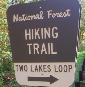
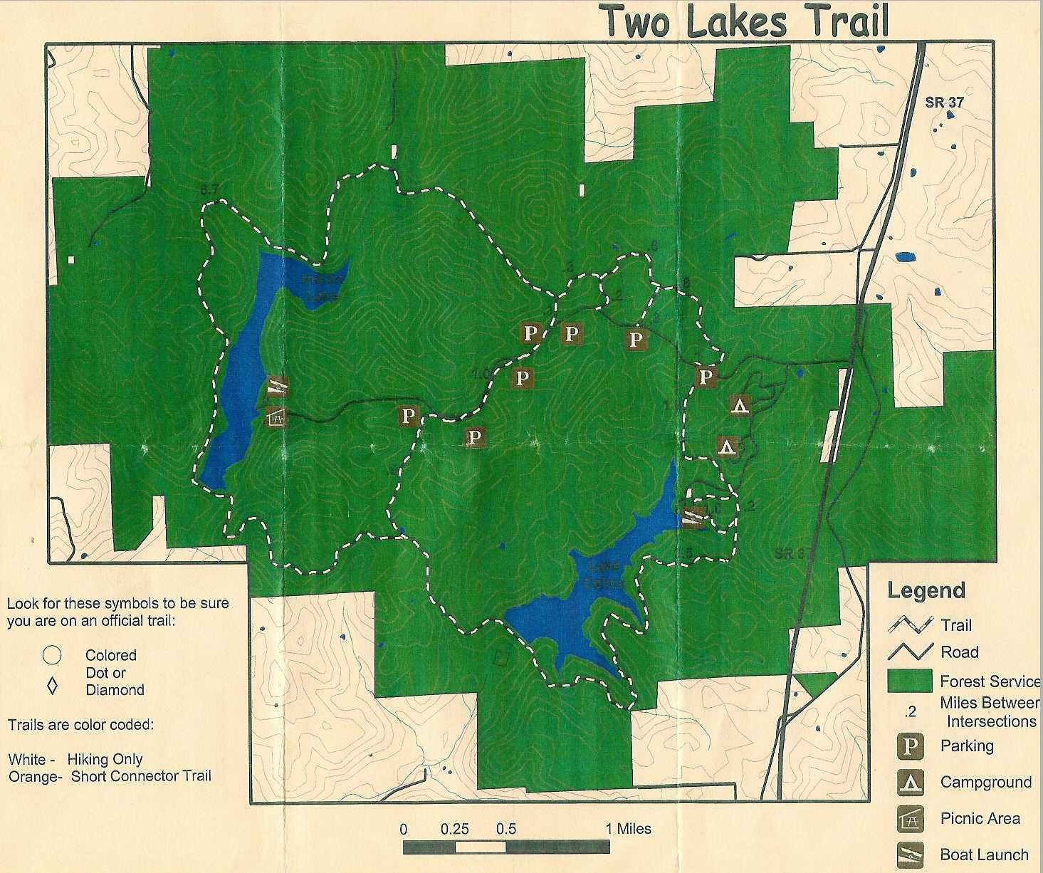
The Indian and Celina Recreation Area
is a tranquil get-away in the midst of the Hoosier National Forest. The
recreation area contains Celina Lake (164 ac.) and Indian Lake (152
ac.). It is located 3 miles south of Interstate 64 off State Highway
37. The recreation area offers camping, electric motor boating,
fishing, and hiking, as well as a interesting historical site.
Oct 21st 2005 -
I started out early after dropping my oldest son
off at school, which was about 7:30 am.I
arrived at Celina lake around 9:00 am. Upon arrival I immediately
made a wrong turn and ended up at the boat ramp near the Rickenbaugh
house, I seem to do this everywhere I go and I’m not sure why. Once I
found the trail head (first parking area on the left), I grabbed my
gear, locked my truck and headed west toward Celina lake. I ended up
hiking the trail clockwise, this wasn’t my intention at first, since
all my info seemed to be for a counter clockwise hike. I thinks it’s a
left handed issue, which explains why I’m not a NASCAR driver.
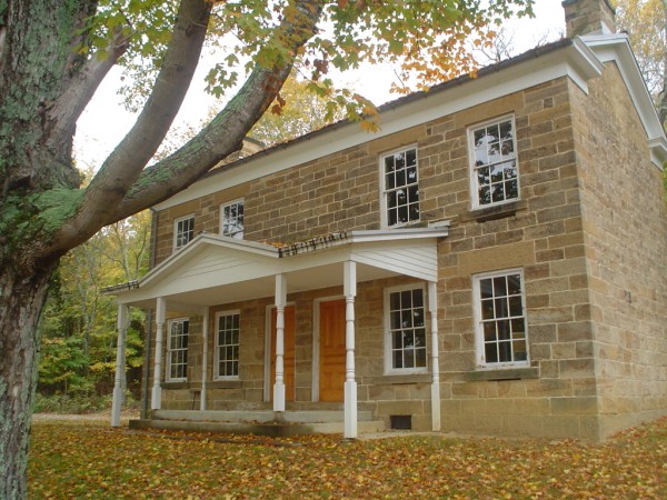
I headed down the trail and soon came to the
interpretive trail and the Rickenbaugh house. I
stopped long enough to check out the home and also to adjust my pack
straps. Better to get things comfortable now so I’m not in pain on the
trail. Prior to arriving at the home I had noticed that the trail
conditions were a bit damp from previous days rain, add some wet leaves
covering a mossy stone and you’ve got a recipe for injury. After
realizing that I need to be cautious were I was walking (this will back
fire later), and making my strap adjustment I headed off into a nice
cropping of rock, interpretive signs
tell you of the Rickenbaugh history here, along with early Indian
usage. From there I headed off to the south side of Celina lake where I
ran into an older gentleman with a rifle, full hunt wardrobe and dreams
of the big gobbler. He explained the trail signs and pointed me in the
right direction, I thanked him and headed on my way.
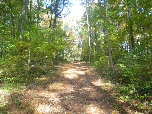
From there it was about 2 miles more or less
through traditional old forest mixed with areas of pine.The
hike was moderate, not too many elevation changes at this point of
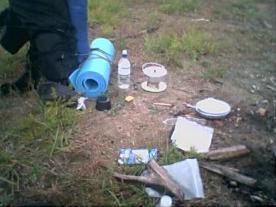
the trail. I came to a small campsite off the trail, but
it was still too early for lunch, and my destination was the dam
crossing at Celina lake.
I took a photo of the campsite and headed towards
my destination for lunch. Not long after leaving the campsite I broke
my hiking stick and had too find a suitable one laying around. I left
mine, which was drift wood, and headed off down the trail again.
Leaving that hiking stick was a dumb move I would realize later at camp.
On a serious note, A hiking stick or pole is one of
the things I’m glad I brought with me, it was very helpful while hiking
uphill and also crossing Tige creek.
After hiking for a while I finally broke from the
forest and headed down hill to a clearing at the dam, the
awesome view distracted me from watching my footing on the trail and I
went down like a large clumsy moose. Luckily the ground was there to
break my fall. I will remember this because coming down the hill I was
listening to a country song about “dust on the bottle”, now every time
I hear that song I will remember falling on my duff at Celina lake.
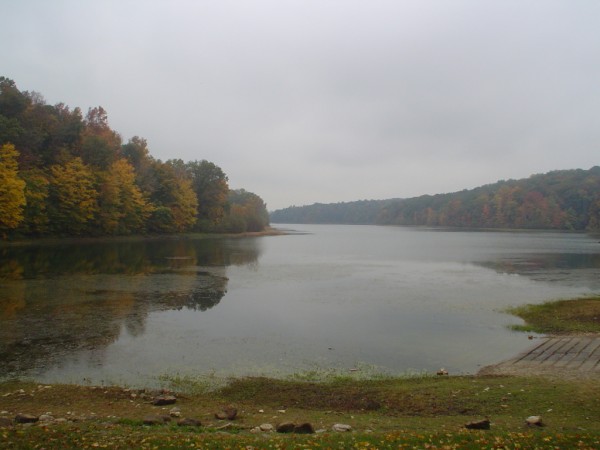
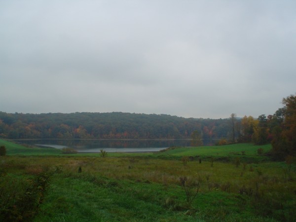
I stopped here at the dam crossing to take a lunch
breakand
to adjust the weight in in my pack, I still was not happy with the
balance of it. It was also a perfect chance to soak up the view a
little bit. It was fairly dark for the time of day, 2:00pm, and it was
starting to mist.
I ate my lunch, refilled my water bottle, packed
everything up and headed off to my final destination for the day at
Indian lake. With a full belly I crossed the dam and headed into the
woods again. This is where I was glad I had a hiking stick because the
elevation changes were becoming more noticeable now. The climbs were
moderate , but were never too long before leveling out again. When I
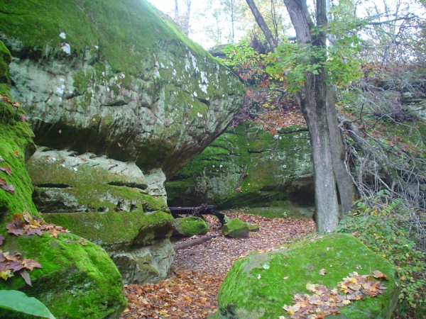
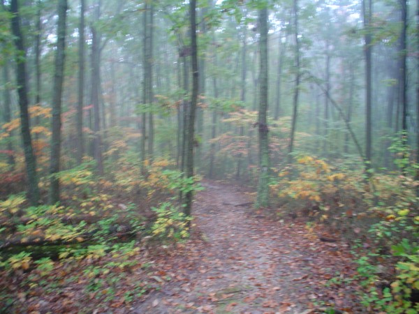
reached the highest point of elevation, I noticed that the weather was
a bit different than before. The skies were really getting dark and
being in a higher elevation it made things seem worse than they really
were. I took a photo here because the air was so thick with moisture, it
looked like one of those movies about 16th
century England.
I actually enjoyed it, it’s something I don’t get
to experience hiking at home. From here I headed down to my final
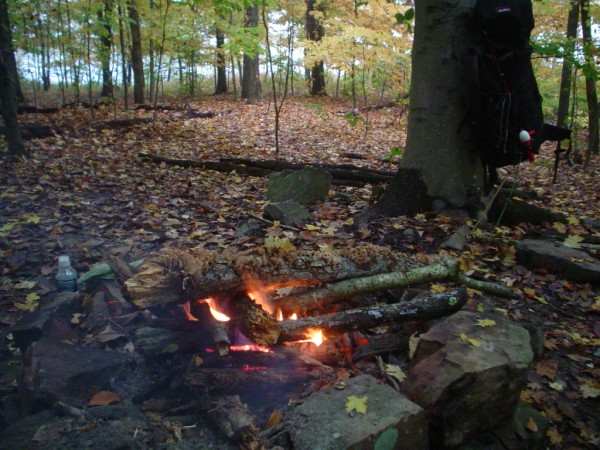
destination for the day. I set up camp at the Indian lake dam, there
was a well established campsite here so I decided to stop for the day.
It was still a bit early for anything, I had just eaten and really
wasn’t tired, so I decided to build a fire. Now I consider myself a
reasonably good fire starter, “just ask my parents about that morning
in ‘74, but I was struggling to get this fire going since everything
was wet and soggy.
Remember the hiking stick I broke and threw away about 2 or three miles
back ?
Well, since the only thing that was going to dry the wood was fire, the
challenge was on! I took about 10 of those cotton ball / Vaseline fire
starters and used about 5 to finally get things burning.
I’d also like to thank the big dead tree next to
the fire, the underside bark was nice and dry. I was quite proud of my
achievement , I took many photos.
I was glad to get the fire going, camping is just
not the same without a nice fire, and the temperature was beginning to
fall into the low 50’s. that not real cold, but it’s enough to make you
put on your extra clothes from your stuff bag. I had everything that I
needed too, thanks to my friends at the thrift stores.
I also had every color covered , but who cares, I
was comfortable and waterproof !
Now that I had established the fire I felt it was
time to set up the tent and get things ready before dark.
“My choice of location will backfire on me later”,
but for now it looks fine. With that done I decided to
Make some coffee and head down to the lake to check out the view and to
relish in my new found tranquility that was surrounding me.
After relaxing for a bit I decided it was time to
rustle up some grub, it
had been about 4 hours since lunch and I was getting hungry. I had 2
choices between chicken w/ broccoli and rice or salmon. I chose the
chicken, I just wasn’t quite sure how to fix the salmon. I was going to
make a patty and fry it in oil over the fire, but I opted for the less
messy of the two.
After dinner I cleaned up and prepared my pack for
the rains that I was sure were going to come while I slept. I really
couldn’t put my pack in the tent with me so I covered it with a 50
gallon trash bag that I brought and it covered the pack nicely. With
that done I climbed into my tent for the night to do some reading
before bed, that’s when I noticed that I had put my tent on a downhill
slope. Now every time I tried to get comfortable, I would just slide to
the front of the tent. Well I was going to have to deal with it, I was
not going to move it now, no way.
I managed to get situated enough that I could read
my story that I had put on my palm pilot, plus I had a few games to
play to make the time pass. It wasn’t long and I was ready to hit the
hay. I never did get comfortable enough to sleep through the night. I
awoke about three times throughout the night and one of the things I
remember most was the rain falling. You could hear it coming from a
distance and then hear it move away. It was very tranquil but was often
poisoned by the sounds of trucks Jake braking on the highway. Aside
from my tent woes, I stayed fairly warm. I never got chilled at all.
I awoke a final time around 4:30am and decided to
just get up. I had heard the rain fall all night long but it never
seemed to make it through the canopy. I was sure from what I heard that
everything would be wet again and a fire would be out of the question,
but it was not. It was as if it never rained at all.
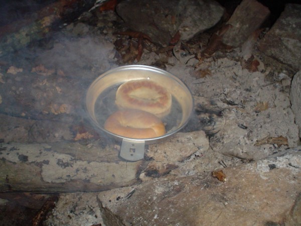
I was actually thrilled that it was dry, now I
could build a fire. The morning temp was in the lower 40’s, and I had
great plans for a lone bagel that I brought along. I ended up having
the same problem with the fire that I had had the night before and I
still haven’t gotten over leaving the dry, broken hike stick on the
trail. Live and learn I always say. I did manage to get the fire going
though, and hey, check out the bagel !
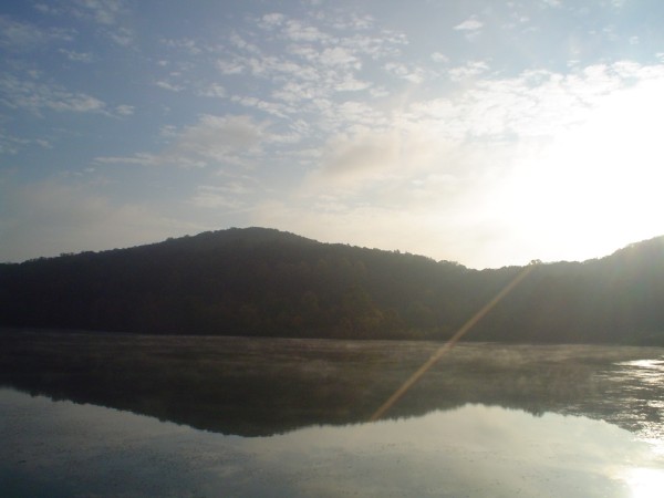
Now with oatmeal, fruit bar and lets not forget the
bagel w/ jelly in hand, I sat around and waited for the sun to rise. I
knew I could get some good shots of the sun coming up over the lake.
Saturday turned out to be a much nicer day than Friday ,the
skies were clear and I got some great shots of the fall colors on a
blue background. I also took some shots of the sun rising through the
trees
By 9:00am I was packed and ready to hike out, I had
stowed my heavier clothes , but left the sock hat out for it was a bit
chilly on the ears.
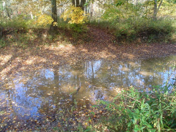
The wooded area on the west side of Indian lake
seemed different from the other wooded areas before, seems like it was
more younger trees or just smaller I walked for a while and took a few
more photos along the way, the weather was looking much nicer now.
After crossing a concrete bridge the trail was
level for a bit but the elevation changes were becoming more common
now. I finally reached the Anderson river, and though I was prepared to
wade through water, it was low enough that I could cross without
removing my boots. From
there I crossed Tige creek and headed into a thick forest of pine
trees. I love pine trees, love the smell and the sound the wind blowing
through the trees. I knew the end of the trail was coming up soon and
thought I’d better soak up as much as possible before hiking out.
The rest of the hike seemed to be uphill most of
the way , GPS read 656’ of elevation but it felt as if I had started at
50’. I didn’t think I was ever going to stop gaining elevation. The
final accent was probably the most challenging for me but I made it to
the connecting trail, followed by the parking area.
This was a great hike, the scenery was great, the
moderate climbs were stimulating, and most of all the piece of mind I
gained from this hike was worth the journey.


