A distinctive sandstone landscape
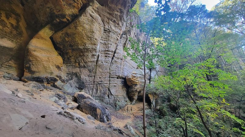
Jeffreys Cliffs Conservation & Recreation Area is a 230-acre natural area near the Ohio River in Hancock County, Kentucky. Sandstone cliffs, large rock shelters, forested slopes, and scenic overlooks give visitors several ways to explore this western Kentucky landscape.
More than six miles of interconnected trails explore the woodland below the cliffs and a roughly 90-acre sandstone plateau above them.
The trail mileage describes the network, not a single six-mile loop. The plateau is part of the 230-acre property, not additional acreage.
Hiking trails & woodland scenery
Lower trails: forest and rock shelters
The lower trails pass through mature forest and former pastureland, providing access to the formation’s two largest rock shelters: Morgans Cave and Tobacco Cave.
Despite their names, these are broad shelters beneath sandstone overhangs rather than conventional underground cave-tour attractions.
Upper trails: plateau and overlooks
A series of stairs at Mossy Gap connects the lower trails with the upper plateau. Upper routes follow the sandstone formation and reach outcrops overlooking the surrounding countryside.
The stairs, uneven landscape, and cliff-edge setting make this a different experience from a level, paved park walk. Obtain a current map before selecting your route.
Sandstone cliffs & overlooks
Cliffs surrounding the plateau rise approximately 75–120 feet above the lower ground. Exposed sandstone, wooded ravines, and substantial overhangs create a landscape unusual for this part of western Kentucky.
Upper-trail destinations include Devils Point, Troop 36 Point, Mossy Gap, Lookout Point, and East View. Overlooks provide views of the surrounding countryside, with the Ohio River visible from portions of the upper area.
Conservation & public access
Jeffreys Cliffs is recognized by Kentucky’s nature-preserve program, and its protection received assistance from the Kentucky Heritage Land Conservation Fund.
Hancock County helped establish hiking access, while volunteers contribute to maintaining the recreation area. The property combines habitat conservation with opportunities for hiking, nature observation, and learning about the local landscape.
Getting there
Travel approximately four miles east of Hawesville on U.S. 60 to Kentucky Highway 1406. The parking area and trailhead are approximately one-quarter mile north on KY 1406, on the right.
The listed address is 715 Willamette Road, Hawesville, KY 42348. The recreation area’s website spells the road “Williamette,” while Hancock County lists “Willamette.” Search by the full recreation-area name to help avoid confusion.
Sources & further reading
Adapted from the supplied Jeffreys Cliffs Conservation & Recreation Area research document. The links below are retained for further reading; operating details have not been independently rechecked for this webpage.
- Jeffreys Cliffs: Official website — area description, trails, hours, rules, maps, and contact information.
- Hancock Is Home: Jeffreys Cliffs — lower and upper trails, rock shelters, and directions.
- Kentucky Living: Jeffreys Cliffs — landscape, overlooks, conservation, and visitor details, September 2025.
- Kentucky Energy and Environment Cabinet: Jeffreys Cliffs — conservation information.
- Hancock County Government: Jeffreys Cliffs — county visitor listing.
Older listings give limited visiting days and approximately five miles of trails. The supplied guide uses the recreation area’s own seven-day schedule and description of more than six miles. Follow current official access notices if details change.