Angel
Mounds Hiking / Biking Trail
in Evansville, Indiana


 Location: Evansville, In
Level: Beginner
Length: 2 Miles
Surface:Packed Dirt
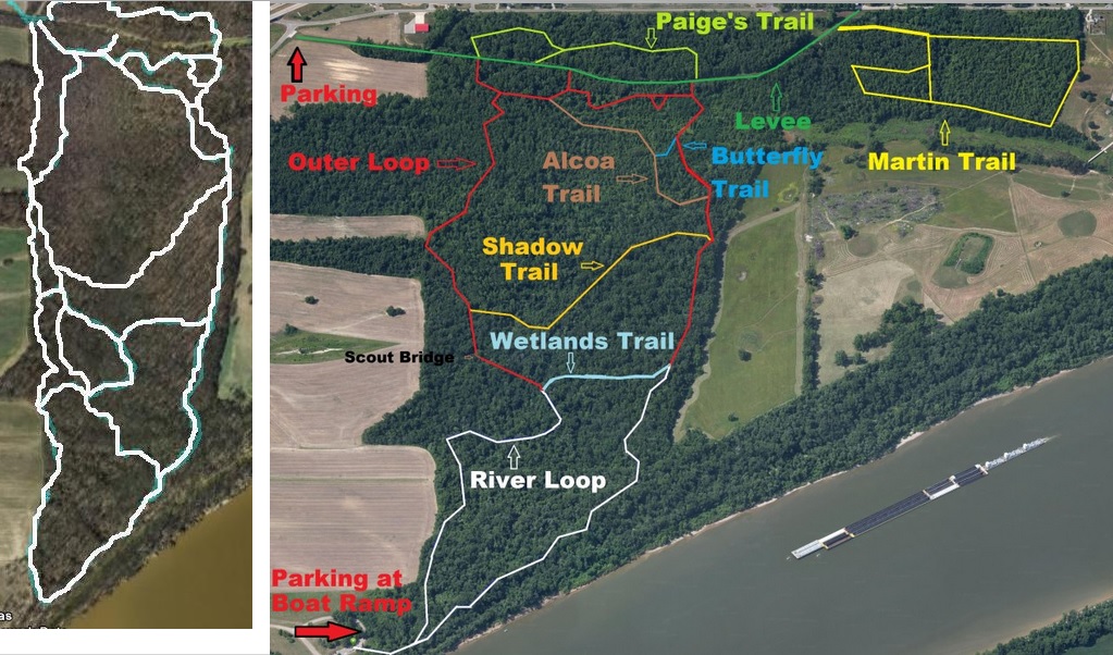
Trail Map: Angel
Mounds Trail Map
See Also:
The
Butterflies Of Angel Mounds
Ticks
and your dog
2005
Tornado Damage
Located
on Evansville's east side
on the grounds of the Angel
Mounds
State Historic Site
 Directions:
Take US 41 through Evansville. Turn east onto Riverside Drive. Follow
Riverside and take a left onto Pollack Avenue. Continue East on Pollack
to the overpass for I-164. Just past the overpass take a right and a
quick left
into parking area. Head down the levee (See Map) till you come to the
trail entrance marked by a sign.
Map Info:
Review:
 This is a fun ride for
less experienced riders. It is very flat and not too long. Due to
tornado damage, logging damage and rerouting of trails, the southern
portion of this trail system is very rutted and rough. If you plan on
riding, it is best to stay on the northern higher portion of the trail.
The best time to ride is during the summer months or early fall, the
southern portion floods during heavy rains.
Historical Reference:
On
Sunday,
November 6, 2005 at around 1:50 am CST (0750 UTC), a tornado touched
down 2 miles (3 km) north-northwest of Smith Mills in Henderson County,
Kentucky, near the Indiana/Kentucky border, and then crossed the Ohio
River into Vanderburgh County, Indiana. Staying just south of I-164,
the tornado traveled to the northeast causing extensive damage to the
Angel Mounds facility.
http://en.wikipedia.org
Click here to view photos of the area taken on April 2nd 2006
|