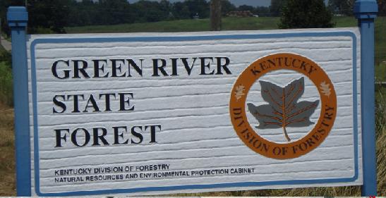
The Green River State Forest consists of 1,106 acres located about
five miles northeast of the town of Henderson in Henderson County.
The Forest, which is managed by the Ky. Div. of
Forestry, is 1107 acres of very diverse land types. These including
mature timber stands, slough areas, and 512 acres of recently planted
tree seedlings. Our goal is to produce a high quality timbered forest
while providing an area for research and demonstration, wildlife
management, and a place for recreation for the public.
Hunting is allowed on the forest and follows state guidelines. Good hunter etiquette is required.
The roads are to be used only by official vehicles.
NO ATV'S OR OTHER MOTORIZED
VEHICLES ARE ALLOWED ON
ANY
PART OF THE FOREST IN ANY MANOR!
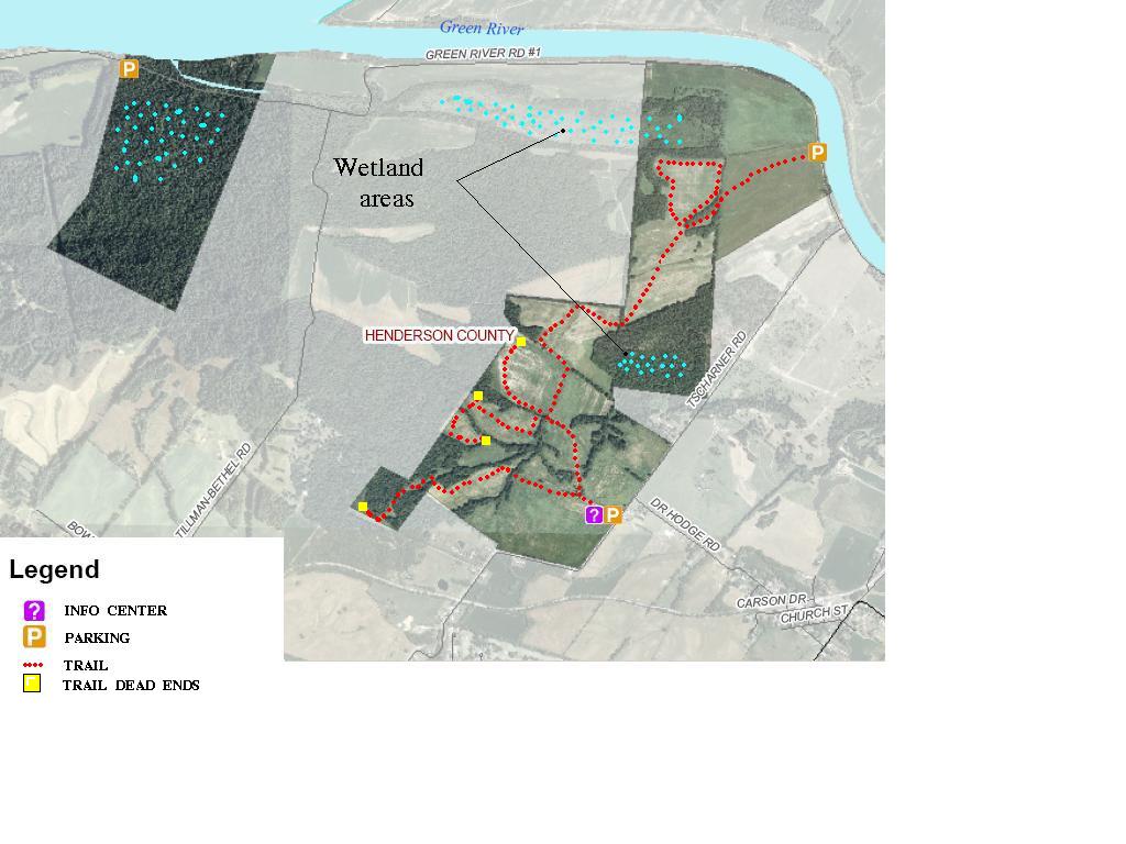
Trails will be mowed in the spring of 2006 throughout the field areas
and will be open for use by foot traffic, bicycles or horseback.
Camping is allowed on the forest but be
sure to know and adhere to the
fire laws.
Directions: north of U.S. 60 and
west of Tscharner Road, two miles east of Henderson, Kentucky and
adjoins the south side of the Green River near its junction with the
Ohio River. Slightly over half of the property consists of bottomland
(which includes about 65-70 acres of swampland), while the rest is
gently sloping uplands.
Notes:
My daughter and I camped out here in the summer of 2008, so we could
explore the trail system and map it our using our gps.
We had a good time, although we ended up losing the gps along the
trail. I had to map the trails from memory, so I may be off a bit on my
calculations. I went back later to see if I could find it but it must
have been
concealed in some tall grass.
The existing trails are primarily just a
mowed path through the fields, If you visit this area and are looking
for a quiet scenic hike, this is the place.
Many of the trails dead end but will take you through many diverse
young forested areas. Also note that some trails are fairly new and
have many small stumps that stick up about 8 inches, if you are not
careful you could possibly cause yourself injury. Towards the
northern most area there is a loop path that takes you right by the
slough area providing a wonderful view, as of this writing the ground
is completely dry but the
elevation in this area is 325 -350 feet and I would assume that this
area
holds water longer than other areas.
Thru out most of the area the
elevation changes are only around 100 feet, anywhere from 350 - 450
feet. Over all the existing trail system is probably around 5-6 miles
in length and is widely spread out over 1100+ acres. There may be more
trails on the north east section, I just didn't quite make it that far.
Be advised that
the Forest property is sort of "cross cut" between privately owned
property, Most of the trails that dead end do so because of private
property. This is also an open hunting area, it's imperative to wear an
orange reflective vest during deer hunting season so that you will not
be mistaken for big game. being visible to other hunters will avoid a
tragic accident.
Please be aware of your surroundings.
Photos
Copyrighted?
names are used in an editorial manner only,
and to the benefit of their owners, with no
intention of infringement of their Trademark? and/or Copyright?.
